California 2012 – Part One | Travel Photography | Big Sur, CA

Prints can be purchased from the following link: prints.chriszachary.com/cali2012

Day One – My brother, his fiance, Allie and I recently returned from a awesome journey out west. From the dates of August 1-9 we explored up and down the Southern California coast. We ventured as far north as Monterey and as far south as San Diego. After flying into San Diego Wednesday August 1st, we immediately hopped in the rental car, picked up a surfboard for John, and started the quest North, to our home for the night, Point Mugu State Park. We stopped in San Clemente on the way to visit with our Cousins Tami & Michael. After a great lunch at The Riders Club Cafe and some quality visiting we started back on the road towards Long Beach, CA.

Click on the Thumbnails to Enlarge

We always seem to underestimate California traffic, especially around the L.A. area. You can always count on traffic to set you back at least an hour. We eventually made it into Long Beach, CA for a quick stop at Tuttle Cameras to pick up my lens rental for the week, a 100-400L lens. I knew I’d need a little more reach since we’d be doing a lot of surfing, so I reserved a rental through BorrowLenses.com. Next stop, Walmart for camping supplies for the next 3 nights. Subtract 2 more hours. Walmart was a zoo and set us even more behind on our precarious itinerary. Finally, after more then 6 hours from departing San Clemente (only a 2 hour drive according to google), we made it to Point Mugu State Park. This state park is placed right on the rocky shoreline of the Pacific, with the Santa Monica Mountains as the backdrop. Delightful. We arrived just before sunset, secured our spot and set up camp. For the three nights we camped, we were fortunate enough to have a full moon, illuminating the landscape. After a delicious dinner, a great fire and a bit of exploring, we climbed into our tents and got some sleep, trying to adjust to the 3 hours we gained on the plane.

Click on the Thumbnails to Enlarge

Day Two – After waking up, eating a little breakfast and packing up camp, we were back on the PCH headed North. We opted to take the PCH (Pacific Coast Highway or The 1) rather than one of the other major highways because, even though it took longer, it took us through a lot of cool towns and landscapes and practically hugs the coast creating some really great scenics. We passed through Oxnard, Ventura, Santa Barbara, Guadalupe, Pismo Beach, San Luis Obispo, Morro Bay & San Simeon, among others, in route to our next home for the night, Andrew Molera State Park. As we usually do, we took our time, stopping to see the sights and look for potential surf spots. We made a quick stop in Santa Barbara hoping to skate a little skatepark on the beach. Unfortunately, the park was closed because of a skate camp but we made up with that misfortune by grabbing a couple Egg McMuffins from McDonalds. We next stopped off at Pismo Beach, hoping to be able to access the Pismo Sand Dunes. Turns out you can only access them by 4 wheel drive, we figured we’d save that adventure for the next trip. Back on the road up to San Luis Obispo to stop at a few surf shops so John can try and find a board sock for his surfboard. I don’t know if you’ve ever traveled at a high rate of speed with a set of soft racks attached to your roof, but it produces this dreadful humming sound that can melt paint off walls. We thought a board sock might help remedy the situation, but after circling blocks in San luis Obispo in a disoriented fashion, we came up empty handed. Back on the road. Next stop was at a beach in San Simeon called Piedras Blancas, not far from Hearst Castle. This beach is home to hundreds of Elephant Seals. These enormous, vile creatures spend their days napping on the sand. Every once in a while, on would get up, move three feet, then lay back down and take a nap. We weren’t sure if they would be there this time of year, as they don’t start breeding until November, but sure enough, they were. After checking those blubbery bastards out for a bit, we got back on the road North. Not long after, the road transformed from a flat, straight coastal road to a mountainous, steep, winding, fall off and instant death-type of road. Allie laid down to keep from loosing her cookies and I became the passenger seat driver, using my passenger double foot brake whenever death was imminent. We stopped at a few choice vista points, including the famous Bixby Bridge. Before we knew it, we were amongst the redwoods of Julia Pfeiffer State Park. Our destination, Andrew Molera State Park, was just beyond Julia Pfeiffer, so we decided to explore Julia Pfeiffer the next day. Since Andrew Molera State Park doesn’t accept reservations for its 24 campsites, we started to get a worried when we noticed all area campgrounds were full. Our worrying turned genuine when we approached Andrew Molera with a “Campsites FULL” sign by the entrance.

Click on the Thumbnails to Enlarge

Click on the Thumbnails to Enlarge

With nowhere else to go, we decided to go into the park anyway and see if the ranger could recommend a place to go. As luck would have it, someone had left early, and there was one site available! Excited about not having to sleep in the car, we parked and started hauling our gear the .25 mile to the site. We set up our tents right next to an overanxious colony of ground squirrels and began exploring the area. We found another trail that leads you directly to a cool little bay, with cliffs overlooking the pacific. The mouth of the bay has potential to be a pretty fun little wave on a decent swell, but it was peeling about knee high so we decided to just explore on foot. We took a ridge line trail up to a bluff that over-looks the bay on one side and the Pacific on the other. It was here where John proposed to Allie! I don’t know if he planned it like this, but it couldn’t have been a better location. I positioned myself a little higher on the bluff while they were sitting on a bench about 200 yards away and discreetly shot some photos of the proposal going down. She of course said yes and they lived happily ever after. We decided to start taking impromptu engagement photos for the rest of the trip which I’ve decided to put in a separate post here on the blog, so look for those. We stayed out on the bluff past sunset then made our way back up the trail to camp, almost getting our eyes gouged out in the process by hungry bats. We cooked dinner under the light of the rising moon, had a nice fire, then crawled in our tents and fell asleep fat and happy to the sound of coyote howls.

Click on the Thumbnails to Enlarge

Click on the Thumbnails to Enlarge


Day Three – The next morning we made coffee, packed up and headed down to Julia Pfeiffer State Park. We knew we wanted to come explore this park for 2 reasons; the redwoods and McWay Falls. If you’re not familiar with McWay falls, it is an 80 ft waterfall that flows year-round and empties directly into the ocean. Paired with the blue-green water it’s a sight we didn’t want to miss. Next we headed into the main entrance of the park and did a little hiking. We took a trail that leads up McWay creek to Canyon Trail Falls and McWay Creek Falls a 30 foot waterfall amongst 300 ft redwoods. The trail didn’t seem very well maintained and we had to do a little scrambling, but we made it to the base of the 30 ft waterfall. We did a little more exploring in the park before packing back in the car for the 5 hour drive back down south. Our destination for the evening, Malibu Creek State Park. We made a quick stop in Cambria for lunch and continued on towards Malibu. We had a little bit of trouble finding the state park. First our iPhone directions took us up the opposite side of the mountain then we ended up in a different section of Malibu Creek State Park, but we eventually found it. Of the three areas we camped, this was probably our least favorite. The area was great, but the park just wasn’t very well maintained and the campsites were packed full of people. But we did manage to sneak off and get some good hiking in before dark. I ran off first because I saw some deer and coyotes in the grasslands so I wanted to get some shots before dark. After seeing a couple dozen deer and 3 or 4 coyotes, it was too dark to shoot, so I packed up the gear and we proceeded to hike up a mountain. It was completely dark by the time we got to the top but the views were still incredible. The great thing about these mountains is they have few, if any, trees, so once you get to the top you feel like you’re actually rewarded for your efforts. Generally, Appalachian mountains are heavily forested so once you get to the top, you hardly know it. We got back, set up camp and started dinner. Later when exploring the bathrooms, some kids pointed out a campsite visitor, a tarantula. Yikes. We didn’t have access to any firewood, so no fire tonight. We crashed out early, knowing we had to get up early to make it to Huntington Beach for the US Open of Surfing.


Click on the Thumbnails to Enlarge

Click on the Thumbnails to Enlarge

Day Four (To be Continued…) – We were surprised to wake up to a little rain and ended up having to pack up camp in the rain, which wasn’t too fun. But our spirits were lifted once we spotted a McDonalds on the way to Huntington… That’s it for Part 1. Cheers.
Keep an eye out for the next post(s) from our 2012 California trip when we stay in Huntington Beach for the US Open….

California 2011 | Part Two | Travel Photographer

Finally got around to putting together Part Two of my California trip. I’ve decided to split this one up into 2 posts as well, so stay tuned for Part Three. Incase you missed Part One, here’s the link, https://chriszachary.com/blog/2011/04/16/california-2011-part-one/. The last post ended on Day 4, the night before we made the trek up to San Francisco. This last leg of the trip had a few mishaps, but still turned out to be pretty fun. Read on to get the scoop and view the photos.

Day Five – March 18, 2011 – We woke up early Friday morning and began our drive North to San Francisco. I rode up with Brett and Ashley in the convertible. We passed through L.A. and stopped in Ventura for a great little breakfast. After breakfast, Brett and Ashley took the main highway up to San Fran for the quickest route, while we opted to take the the Pacific Coast Highway for the scenics. After driving through the coastal mountains we made our first stop in Malibu.

After scoping out the break and exploring a little we hopped back into the car and continued our journey north, making countless stops along the way. One stop that was noteworthy was at this point (where apparently a pretty decent little point break wave shows its face from time to time) the road took a sharp right around this rock formation, it looked the the mountain was broken off in order to pave the road through, leaving this huge rock sticking straight out of the ground. Looked really cool. We tooled around there for a bit, took a pee break and started back on the road.

Starting back on the road, we stopped by a little break, not sure of the name if this one. Might be Zuma, not 100% on that, but we thought we’d stop and check it out. It was a little blown out, but we saw a couple guys paddling out. Hung out and watched them for a bit before heading up the road to Rincon.

Rincon is one of the most famous surf spots on the California coast. So we weren’t surprised when we pulled up to a full lineup. This spot is frequented by the likes of Kelly Slater, Bobby Martinez, Connor Coffin, Josh Kerr and many more big names. The only one I recognized out there was Connor Coffin. There were some pretty decent sets reeling off the point, and dudes were ripping. I sat out on the point and shot some photos, while John went for a little surf.

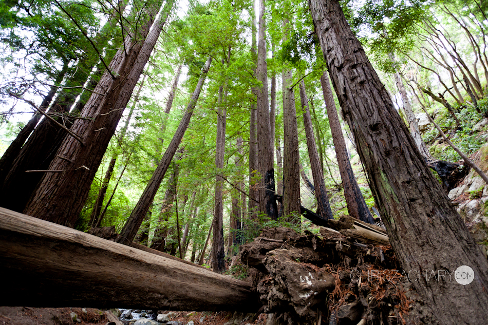
When we left Rincon we continued up the Pacific Coast Highway, heading towards San Fran. Made a quick little stop at a mexican deli for some jalepeno croissants and popped in a Walmart for a AUX cable for some fresh jams. Now here’s where it starts getting a little hairy. We were really stoked on this section on the PCH. The section between Santa Barbara and Santa Cruz, this is where it passes through the Big Sur, there are redwood forests, waterfalls, and sea lion colonies that we really wanted to see. We knew we were running a little behind on time, so we started scoping out cabin locations in the Big Sur to stay for the night. After finding one, we called to make a reservation. When talking to the folks at the camp ground they informed us, just two days earlier, a landslide had washed out a 15 ft section of the PCE, forcing them to close a 40 mile section. Meaning we had to back track and take another highway up to Santa Cruz. As a result, we missed all the cool scenic stuff we were so excited about seeing. Needless to say, we were a little bummed. And on top of that some storms were moving in. So we made to Santa Cruz as fast as we could and decided to stay there for the night.

Day 6 – March 19, 2011 – After a good nights rest in a sketchy little bed & breakfast in Santa Cruz, we explored the downtown area in search of a Starbucks. We awoke to more storms including some pretty good size hail. We came to the conclusion that Santa Cruz is a pretty sketchy place, especially at night. We came across some pretty interesting characters. Our hotel was located right in front of the popular Santa Cruz surf break called Steamer Lane. There wasn’t much going on as far as waves, pretty much victory at sea, big, choppy and stormy. There appeared to be a surf-kayak competition going on. We scored some Starbucks and reunited with the PCH. There was one spot I had mapped out before hand that I wanted to shoot some landscapes at. Natural Bridges State Park. I didn’t get to set up a good shot like I wanted to, due to the rain but I put together a couple HDRs. I think you’ll see why they call it Natural Bridges. After that we headed on up to Half Moon Bay, to scope out the big-wave spot, Mavericks.

We eventually made it to the big wave spot; Mavericks. A well-known hawaiian surfed drowned here just a week or so earlier and there were memorials in honor of his passing. The ground was wet and muddy, but me and John still hiked up to the cliff to get a over-view of the wave. We hung around here for a bit checking out the scenics. After stopping for some fine italian cusine for lunch, we jumped back on the PCH.

We finally made it to San Francisco! We stopped by a little wave called Pacifica on the way in. I think this is where the Ripcurl Pro Search is going to be this year. Thats it for this post. I will have Part Three up in a day or so, keep a look out!

To be continued….
Up Next: Our visit in San Francisco, stay tuned…